
My team, Team D.A.R.T., has 10 members, which means six of us run four legs and four of us run three legs. Our team is renting two passenger vans to support the runners. Each van has 5 runners, and just one van is "active" at a time, so Van 1 runs legs 1-5, then hands off to Van 2, which takes legs 6-10, and so on until we are finished. The runners must proceed in order, after we've done 10 legs, runner 1 completes Leg 11, and we continue in this manner for the rest of the race. You're not allowed to change the order of the runners during the race, unless someone is injured, in which case they are removed and the runners complete the rest of the legs in their original order minus the one injured runner.
The course wanders through the backroads of Virginia and North Carolina, from Grayson Highlands State Park in Virginia to Asheville, NC. Somehow, I talked my wife Greta into joining me as I drove the length of the course. She proved invaluable as a navigator; there are lots of turns on twisty mountain roads, and it would have been easy for me to get lost without her. After a two-hour drive, we arrived at Grayson Highlands at 11:00 a.m. -- coincidentally the same time D.A.R.T. be starting the relay next Friday morning. The park is well-manicured, and the visitor center is near the top of a 5,000-foot peak. Here's the one photo we managed to take during the entire day, a third of a mile up a trail at the mountaintop:
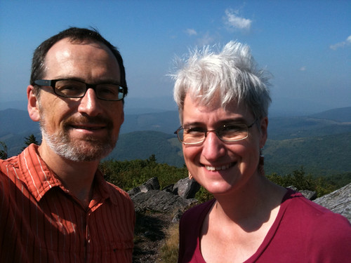 |
| I don't think they're starting the race all the way up here... |
The first leg of the race plunges 1,000 vertical feet, 4.2 miles from the visitor center to the park entrance. The lucky runner is Kurt Graves. He won't be so lucky later on when on leg 31 he must climb 1,430 vertical feet in just over 5 miles! After Leg 1, the course winds down quaint country lanes, along gravel roads, up mountains, down the other side, and back up again. After an hour of driving we had completed just 5 legs. This was going to take awhile! We decided to stop for lunch in West Jefferson, NC. In fact, my van, Van #2, could do worse on race day than to have lunch at the same spot.
The next leg, let 6, would be my first. The run is entirely on "Buck Mountain Road" and "Bald Mountain Road." As you might guess, it involves a lot of climbing. It starts with a 200-foot climb, then a steep descent on a gravel road, through Mile 2.5. Mile 2.5 to 4.5 involves 400 feet of climbing, including an 8% grade for the last mile. Yikes! On the official race scale (Easy, Moderate, Hard, Very Hard, Mountain Goat Hard), this counts as "Hard."
The first "Very Hard" leg isn't until Leg 10. Mark Ippolito will run this one, which is 8.2 miles long. It features another 400-foot climb with another 8% grade, but this leg is 8.2 miles long compared to my 5.2-miler, so I guess that's what makes the difference. After finishing our drive-through of this leg, at about 2:15, we did a quick calculation and determined that if we tried to drive all 26 remaining legs, we'd not only be utterly exhausted, we'd miss our 8:15 dinner reservation. We decided to skip Van 1's legs and go straight to the start of leg 16, my next leg. This "easy" 4.2-mile leg includes one 200-foot climb, but otherwise it's mostly downhill. I'll be running it at around 11 p.m. When we arrived at the start of Mark Ippolito's second leg, Leg 20, we realized it was going to be a very windy road, and we were still running short of time, so we skipped ahead again, this time to leg 26. It's a "Moderate" 4.5-mile route with about 374 feet of climbing. The navigation isn't difficult either. I'll be running this one at 5:00 a.m. after attempting to sleep in a church parking lot, so that may be my biggest challenge. The next few legs covered mostly rolling hills and didn't seem too difficult. But it was around 5 p.m. now and we couldn't figure out a way to skip Van 2's legs 31 to 35, so we went ahead and followed them as well.
Kurt's leg 31 is an absolute beast of a run, 6.5 miles long, with a non-stop, 1,430-foot climb for the last 5 miles, a solid 6% grade the entire way. Next Dave Moore takes the bracelet and runs downhill for 9.4 miles, nearly all of it on gravel roads, a 2,000-foot drop at 5-7%. That's tough on tired legs! Then Stephanie has an 800-foot climb with 13% grads for the last mile -- another "Mountain Goat" leg. Dave Fischli's Leg 35 doesn't look much easier to me, with 951 feet of climbing in the first two miles. Finally, he'll hand the bracelet to me and I'll take the captain's privilege of running the final leg. The first mile or so is uphill, then I start a 5-mile descent to Asheville, a drop of 1,276 feet. It's fairly steep in some places, and is considered "Very Hard." I'm hoping my legs won't be so tired that I can't cruise down these hills at top speed. The road changes quickly from a forested hillside into urban streetscape, where hopefully my teammates will be waiting to greet me!
Take-home lessons:
- This is a fantastically beautiful run. There is drop-dead spectacular scenery through much of the race, and most of it is rarely seen by tourists because it's on little-traveled backroads.
- Whoever is driving, especially during the early legs of the race, will need a navigator to help with directions. There are tons of twists and turns and missing one could be fatal.
- Distances are critical. Often the only way we spotted a turn is because we knew it was coming 0.8 miles after the previous one. Fortunately the race directors have put together a fabulous package of instructions for drivers and runners, so as long as you follow their directions you should be fine.
- The distances are given in distance from the previous turn. But runners should probably also carry cumulative distances. (In other words, if turn 1 is at 0.7 miles and turn 2 follows 0.8 miles later, the runner's instructions should point out that this is 1.5 miles into her/his leg.) This will match the display on their GPS.
- Even if we screw up and get lost a few times, we'll probably still have a fabulous time. This is going to be a tremendous race.
Details of today's run are below.
We spent last night in Asheville, and I needed to get in 8 miles (which, combined with tomorrow's half-marathon preview, will give me 70 miles for the week). So I plotted out a course that seemed relatively simple to remember and got out to a nearby lake. As it turned out, the lake was quite beautiful (and surrounded by million-dollar homes), but the route between the motel and the lake was more "industrial hellscape" than "charming country lane." Oh well, I got the miles in.
Since Theoden just linked to this post as a place with good advice for Blue Ridge Relay runners, I thought I'd link to a post with some even better advice. This one is directed at Hood-to-Coast runners, but the same advice applies to Blue Ridge.
ReplyDelete